Saturday, November 26, 2022

A beach walk at Costa Rei


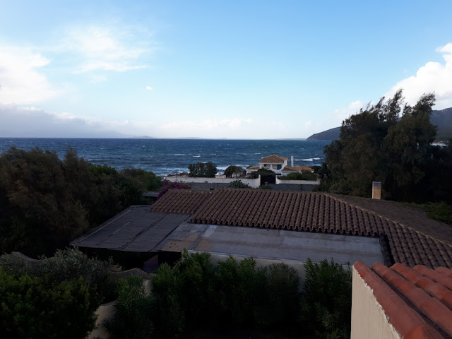
It's 7:15 on this windy Saturday morning, and the sun will rise in a few minutes. We've watched sunsets from the rooftop terrace, the sun disappearing between the roofs of two hilltop houses rather than in the ocean at this time of year: days are short here, too, and the sun sets shortly after five pm. We can't see the sun rise from here, but I can see already that it's a bright day, last night's thunderstorm blown over, literally. Wind has been a nearly constant companion on our daily excursions, but we have been very lucky with the weather.

After two hikes on Wednesday and Thursday a bit east of here past Costa Rei we decided on a beach walk at Costa Rei yesterday: for once the morning was absolutely calm. We spent three hours walking along the 10 kilometre long beautiful white sand beach that must be very crowded during high season. Yesterday we encountered only three people, one dog and a few gulls and cormorants. The temperature was a pleasant 20 degrees Celsius, just like the day before, and even though a breeze started up on our way back blowing in towering thunder clouds it was warm enough to walk in shorts and short sleeves. Marietta and Johann even decided on a swim, the clear water about the same temperature as the air.


The drive to Villasimius, a neat village about half an hour from here close to Costa Rei, took us along the rugged coastline on a very curvy road with stunning views around every corner, but on the way back we decided on the faster freeway: the looming clouds made it advisable to get home without delay.


The fierce wind from the middle of the night has given way to a nice breeze, so that nothing should stand in our way to explore Cagliari, Sardinia's capital city, today.


Thursday, November 24, 2022

A trip to Sardinia's south coast


November 24th, 2022

It's a quarter to eight in the morning here in Geremeas at the southern tip of Sardinia. The comforting warmth of the pellet stove beside me is a nice counterpoint to the howling wind that's playing with the golden hibiscus and pink and red bougainvilleas in the small yard, but I know it sounds and looks worse than it is: it's a warm wind, and it won't keep us from exploring this area with its rugged beauty a little more today on our hike.


We arrived here – our friends Manfred and Marietta, Johann and I – after driving from the ferry at Olbia, 300 km to the northeast, two days ago.

Right now I am waiting for the bread dough which, covered with a tea towel, is rising on the wood stove beside me: I've been tasked with making buns for breakfast. The next supermarket is about twenty minutes away, and the little bakery that's within walking distance is closed for the season, as so many other restaurants and tourist-oriented venues. Far from lamenting this fact I'm glad about it: there are very few people here at this time of year, quite different from the summer, as we've been told, when parking spots this close to the beach are very hard to come by and beaches are teeming with people, streets are crowded and noisy.

When we arrived on Tuesday the wind was blowing hard and it was cooler than it is now, but the sun was shining from the bright blue sky, a perfect backdrop for the foam-capped waves lashing the beach. We had chosen this particular destination – Geremeas, about half an hour from Cagliari, Sardinia's biggest city – because Marietta's brother and sister-in-law own a house here, our home for the five days we are here. It is rented out in the summer months, between late May and early to mid September, and nobody had stayed here in six weeks. We opened the shutters and got settled in, put away the groceries we had picked up at a supermarket along the way, and made our way down the road to the beach, a walk of five minutes. It didn't feel like the mediterranean just then, the waves and wind reminiscent of a more northerly sea in the summer, except for the palm and olive trees, the cacti, the ochre, light yellow and white-washed houses and villas. 


Just like yesterday we plan to hike today, but right now the buns are ready and it's time for breakfast. Hopefully we'll be able to get water from the taps again today; yesterday afternoon it stopped running for no apparent reason. A bit of improvisation isn't a bad thing, though, and so far we are doing fine.


Thursday, March 31, 2022

A hot day in Canyonland NP, Utah


March 31, 2022
Bozeman, MT

The internet in the last two hotels was very poor, so I can only post now what I wrote yesterday in Idaho Falls, ID.

It's already up at the freezing mark, and the sun is shining from a clear blue sky. Yes, we obviously have come a long way since the last time I wrote: after visiting Canyonland NP on a very hot day on Sunday and Arches NP with pleasant 21 degrees on Monday we left Green River, about an hour from Arches, in the rain yesterday morning. Cloudy skies with intermittent showers stayed with us, and on the long climb up to Soldier's Pass south of Salt Lake City it was only +5 degrees, but by the time we reached SLC it was back to +14, only slightly cooler when we reached Idaho Falls in the evening, our destination for the night.

It was a driving day yesterday, with no break to take a walk, just a few stops to stretch our legs, but we did enough walking/hiking the two days before, and in a gorgeous landscape at that.


Since Canyonland NP is quite spread out and consists of two different parts we decided on the southern part, 'The Needles', which is closer to Blanding, where we stayed the night. It still was about an hour's drive until we reached the turn-off to the park, and another 50 km from there to the visitor centre. Up to the park entrance itself the road leads through open range with Texas gates, and there was ranching even in the park itself into the Seventies. There are no lush pastures here, just the usual small shrubbery, at this point looking pretty dry, too, but the cows we saw seemed quite content, maybe a bit on the skinny side. But of course we have often seen in South America how sparse vegetation can still sustain a herd of cattle. Cows, like other animals and plants, have an amazing ability to adapt to what's available.


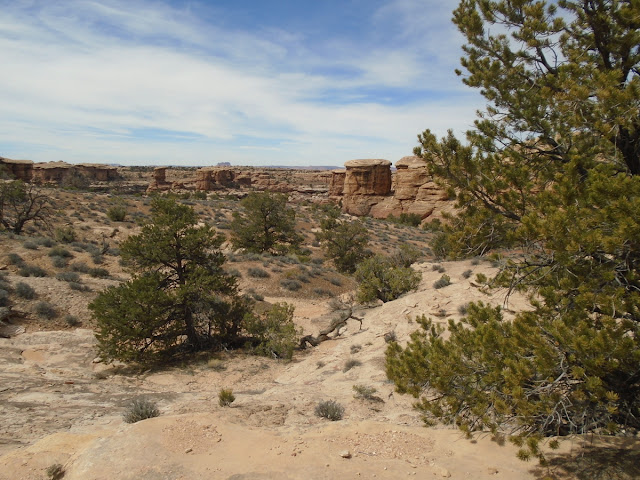
Even before reaching the park entrance the landscape is interesting, at times stunning, with high sandstone walls, and hiking trails lead into the hills. We reached the visitor centre at lunchtime, picked up a map and got some hiking tips from the ranger. The visitor office closes at five, but the park is accessible 24 hours. Since we didn't have time to stop at all the view points – not that it would be necessary or even desirable to just check them off a list – we started at the point furthest away from the visitor centre and hiked the Slickrock Trail.


On this trip, finally, I realized that all these years I talked about 'sliprock' when the right term would have been 'slickrock'. My apologies to anybody who read this and knew better. :-) Maybe it was a Freudian slip because I was afraid to slip on the rock? In any case, I still think my name was not totally inappropriate either and descriptive enough, even though usually this smooth rock is great to walk on even on quite a slope: the footing is a lot firmer than on loose sand and gravel. Even if submerged in water, as on entering the first and hottest of the pools at the Arizona hotsprings, this is still true.

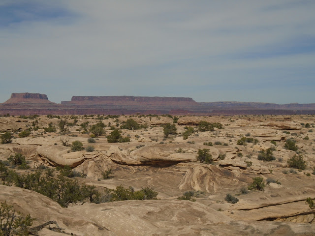
The biggest difficulty on this trail would have been to not get lost, but very regularly places small cairns made it easy to find the right way. Walking on slickrock almost the whole way, with just a little up and down, we had stunning views all along the way, gazed into canyons with colourful, many-layered and textured rocks and saw the snow-capped mountains in the distance. It was very hot, 27 degrees when we started and likely warmer during our hike, and there was very little shade, and I struggled a bit with that. For the scenery and the views it couldn't have been any better, though, and a rest at a sheltered picnic spot cooled us down a bit again.

Pothole Point, our next stop, would have been more interesting after a rain. Here, potholes in the rock, like tide pools, are home to a community of small creatures like mollusks and worms who need to make use of the brief time before the water evaporates again to proliferate. Now, the potholes were dry, but of course they are still homes for these small creatures and visitors are asked to avoid stepping in them. Not all heed this, sadly, just like not all stay away from the fragile soil.


Compared to the first two hikes the third led through an almost lush area. On the Cave Creek trail we encountered gambel oak, skunkbrush, rabbitbrush and several other woody shrubs, all possible because of a spring. Water seeps out of the rock in one of several caves facing these bottom lands, enough that it even provides enough moisture for small ferns forming a bright green fringe along the wall. These conditions made this area a favourite place for people: rock etchings (which we missed, somehow), and the smoke-blackened ceilings of the caves indicate that thousands of years ago this was a place of shelter. In another cave we could see remnants of an old cowboy camp. I enjoyed the plants, as always, and also the shadier, a little cooler conditions on this hot day, and even the mention of two ladders by the ranger didn't deter me: after visiting Bandelier NM in New Mexico a few years ago I know that they don't pose an insurmountable obstacle for me. These here were just a couple of metres high, anyway, so no problem at all.


The last stop was very close to the road, aptly called Roadside Ruin. Tired from the heat, we were quite happy that it was only maybe three hundred metres of easy walking to get there. It turned out to be not a ruin at all, but a very well preserved semi-circular small structure attached to the wall of a cave. The assumption is that this was used for storage, possibly a kind of grainary. It was high enough above the bottom of the canyon that filling and emptying it would have required an effort, but not impossible by any means.

At the parking lot for this little hike we met a couple from Victoria, BC, the first Canadians in quite a while, who told us that they had decided to visit Canyonland first and Arches the next day because Arches was so congested that people were being turned away. It hadn't even occurred to us that this could happen: Canyonland was very quiet, and we didn't yet know that Arches is one of the most visited national parks in the US. What would expect us the next day for our planned visit?


Monday, March 28, 2022

No way down: Canyon de Chelly


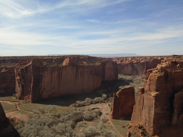
It's Monday morning, the beginning of our last week of this journey, and I'm sitting at the desk of our hotel room here in Moab, Utah, trying to get a start on summarizing the experiences of the last two days. I'm stalling, wondering why. Maybe it is the fact that I read about changing weather - indeed, it is cloudy this morning, for the first time in quite a while -, have been thinking about the way home (not a good idea to do this prematurely, even if, as Rainer Maria Rilke advises in a poem, you should be 'ahead of all parting, as though it were already behind you'). It might also be due to the impressions from the last two days, the immersion in a landscape so magnificent that it is hard to find words to describe it. Nevertheless, I will try and let the photos do much of the talking

Two days ago we visited Canyon de Chelly (pronounced d'SHAY) National Monument, whose nearly 84,000 acres lie within the Navajo Reservation and are administered by the National Park Service. It is the home of the Diné, the Navajo people, who have lived here for the past 400 years, the latest in a long line of settlers which started in the archaic period, 2500 – 200 BCE, followed by the Basketmaker people from 200 to 750 CE, the Pueblo from 750 to 1300 and the Hopi, 1300 – 1600, each with their own rich history.

The Diné brought domesticated sheep and goats and planted crops and orchards on the canyon floor, and they farm in the canyon to this day.


We had hoped to do the only hike possible without a guide on our visit, the White House Rock trail which descends nearly 200m to the canyon floor and crosses the Chinle Wash; we'd have been able to view cliff dwellings from there, too. Sadly, however, the trail is closed now, supposedly because of the high number of break-ins into cars parked at the parking lot. Thus, we could only follow the scenic drive and stop at the different lookouts.


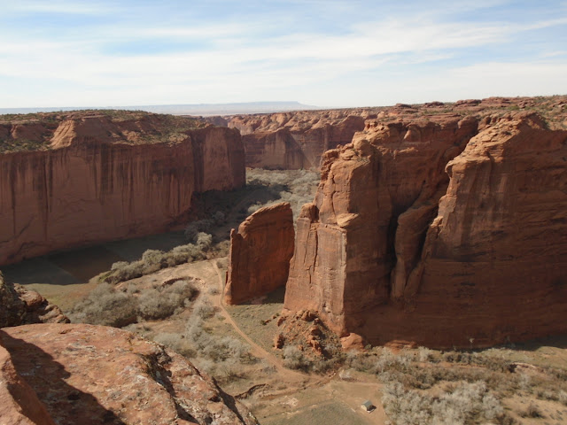
We had decided on the South Rim Drive and drove all the way to the furthest point, Spider Rock Overlook. This is one of the most remarkable features of the canyon, an 800' (240m) high sandstone spire that rises from the canyon floor. I can only imagine what it must be like to stand at its foot and look up.

There was very little traffic in the park that day, no crowds at the different view points, which was a nice surprise. There was no rush to make room for somebody else to look into the canyon, and I was happy to let the magic of this gorgeous place sink in.

At Junction and Tsegi Overlooks we had a great view of the canyon floor, saw tilled fields and pastures, corrals and the cottonwood trees that line the banks of the wash, even watched two riders slowly make their way along the trail.


In one of the parking lots a Navajo woman named Darlene Sam had spread out jewellery and some pottery on the hood of her car. She told us that she lived down in the canyon, but because tourists can no longer walk down she is now hiking up and offers her crafts here. I bought a vase depicting symbols from Navajo history and mythology. Darlene was taught by her grandmother and now teaches her own daughter, who, at twelve, has made the beaded bracelets that were part of the display. I learned how the materials found in and on top of the canyon are used in jewellery, medicine and spiritual ceremonies. Juniper berries are used in many of the bracelets and necklaces, in fact, all parts of this plant are highly valued, the branches used to cleanse and purify in ceremonies.

The park, or rather the visitor centre, closes at five, and by that time we had seen as much as we could have hoped for and were on our way north again, to spend the night in Blanding, Utah, a reasonable distance for the drive to Canyonland NP the next day. Once again we changed time zones and are now back in our home time zone, MST. Canyon de Chelly, while still in Arizona, is on Utah time. 


Sunday, March 27, 2022

Walking back in time: Petrified Forest NP, AZ


It is a cool, crisp morning here in Blanding, Utah, where we spent the night. We'll soon be on our way to nearby Canyonlands NP.  

                                ~~~~~~~~~~~~~~~~~~~~

The drive from Globe to the Petrified Forest NP led through unexpectedly dramatic country. I suppose I should have clued in that this could happen if I'd paid more attention to the mention of Salt River Canyon here and there in brochures of the Globe area, but I didn't, and thus I was totally unprepared for what expected us. From Globe the road rose slowly for a while, the colours of the landscape around stark and beautiful. And then we started the descent into the canyon, in long serpentines, sometimes hairpin curves, through huge spires glowing in many hues of red and brown—no description can do this justice. This is Apache country, and, having grown up in Germany with the books of the German author Karl May, who, never having been on this continent, described the adventures of 'Old Shatterhand' and his Apache friend, Winnetou, I tried to put what I read as a kid together with what I experienced now. While there was no Winnetou, ever, people have lived here for thousands of years, and once again I could only marvel how they survived.
Once we had climbed out of the canyon again and had passed the (obvioulsy very tourist-oriented) town of Show-Low the landscape reverted more and more to the dry, sandy plains we have traversed often here in the southwest. Petrified Forest NP is part of this landscape where erosion has shaped not only the badland mesas and valleys but has also exposed the petrified trees this park is named for, as well as many other fossils, and continues to do so.

When we turned off the highway we stopped at the visitor centre for some information and a map and soon found that this was not the NP visitor centre but one administered by the Navajo Nation. The park is part of their lands. We admired some of the pricey artwork created from petrified wood, among others a huge block that weighed 28,000 lbs.

It is not surprising that security is tight in this park: thefts have occurred, though not as widespread and damaging as rumoured. Shortly after we passed the entry gate flashing lights indicated a road control: we were asked if we could answer a few questions regarding our experience at the gate with the ranger admitting us. I'm not sure what this was about; is there a constant review of these park employees to make sure that they don't aid in possible theft?

Armed with the official map of the park and some tips where best to spend the 2 1/2 hours we had left until the park closed at five (we didn't know this before we came) we were on our way to the first stop.


“Crystal Forest” is probably the area with the most concentrated incidence of petrified logs in the park. Trails connected with the different view points are paved and thus easy to walk, and this one was just over a kilometre long. It is strange and beautiful to see these crystallized logs scattered all over, to think that all of these were once trees, most of them of tropical origin. During the Triassic Period all of this land resided on the supercontinent Pangea, at about the latitude of present-day Costa Rica. When Pangea broke apart, the North American continent moved northward, and over the next several millions of years the Colorado Plateau lifted up by about a mile. This is the reason why it is so arid here now.

This area was once at the edge of a river channel. Fallen trees crisscrossed the channel and some of the adjacent floodplain. Periodic flooding buried some of these trees under layers of silt. Over time, silica-enriched groundwater percolated through the logs and replaced the organic material, creating a replica in quartz. Erosion continued, exposing the now petrified logs. The colours of these logs are of an amazing variety, ranging from white over grey to red, with all kinds of hues in between. This is due to impurities in the quartz: red, orange, yellow and purple indicate iron oxides, black and grey manganese oxides, and white is pure quartz. (I garnered all of these facts from the signs in Crystal Forest)


Following the rangers recommendations we next stopped at Blue Mesa, an area not unlike our Alberta badlands near Drumheller, where we walked the mile-long paved trail.


The last stop, shortly before leaving the park again, was at the northern end, aptly called Painted Desert. The late afternoon light was especially advantageous to view it, though it would have been even more impressive closer to sunset. Since the park closes at five, however, we didn't get to wait that long.


I-40 took us to our night's destination at Chambers, the starting point for yesterday's visit to Canyon de Chelly – which I will talk about after our day's adventures at Canyonlands NP.