It's Monday morning, the beginning of
our last week of this journey, and I'm sitting at the desk of our
hotel room here in Moab, Utah, trying to get a start on summarizing
the experiences of the last two days. I'm stalling, wondering why.
Maybe it is the fact that I read about changing weather - indeed, it is cloudy this morning, for the first time in quite a while -, have been
thinking about the way home (not a good idea to do this prematurely,
even if, as Rainer Maria Rilke advises in a poem, you should be
'ahead of all parting, as though it were already behind you'). It
might also be due to the impressions from the last two days, the
immersion in a landscape so magnificent that it is hard to find words
to describe it. Nevertheless, I will try and let the photos do much
of the talking.

The
Diné brought domesticated
sheep and goats and planted crops and orchards on the canyon floor,
and they farm in the canyon to this day.
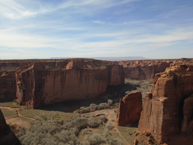
We
had hoped to do the only hike possible without a guide on our visit,
the White House Rock trail which descends nearly 200m to the canyon
floor and crosses the Chinle Wash; we'd have been able to view cliff
dwellings from there, too. Sadly, however, the trail is closed now,
supposedly because of the high number of break-ins into cars parked
at the parking lot. Thus, we could only follow the scenic drive and
stop at the different lookouts.We
had decided on the South Rim Drive and drove all the way to the
furthest point, Spider Rock Overlook. This is one of the most
remarkable features of the canyon, an 800' (240m) high sandstone
spire that rises from the canyon floor. I can only imagine what it
must be like to stand at its foot and look up.There
was very little traffic in the park that day, no crowds at the
different view points, which was a nice surprise. There was no rush
to make room for somebody else to look into the canyon, and I was
happy to let the magic of this gorgeous place sink in.
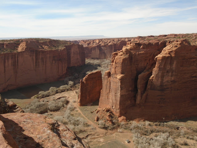
At
Junction and Tsegi Overlooks we had a great view of the canyon floor,
saw tilled fields and pastures, corrals and the cottonwood trees
that line the banks of the wash, even watched two riders slowly make their way along the trail.


The
park, or rather the visitor centre, closes at five, and by that time
we had seen as much as we could have hoped for and were on our way
north again, to spend the night in Blanding, Utah, a reasonable
distance for the drive to Canyonland NP the next day. Once again we
changed time zones and are now back in our home time zone, MST.
Canyon de Chelly, while still in Arizona, is on Utah time.


No comments:
Post a Comment