Saturday, March 23, 2024

An ugly hole, an interesting town: Bisbee, AZ


In my chronological report I left off at Columbus. Again the weather forecast prompted us to move further west, and we chose Bisbee, AZ as our destination for the night. We continued on the same narrow highway on which we drove to Columbus, SR 9, which led us at first through the same kind of country: flat, shrubby, arid, at this time of year and under a grey sky looking somewhat depressing. Once the road climbed up into higher elevations the area became more interesting, and finally we arrived in Douglas, another town very close to the Mexican border. We had looked for a restaurant to have a Mexican meal online and decided on the Original Grand Cafe located on the generously laid out Pan America Avenue. Despite its attractive historic town centre we didn't see any tourists, but we did find the tourist information and watched an informative video talking about the town's history. One question was answered in the course of it: Douglas was a planned town, and the streets were this wide in order to accommodate 20 mules turning. Not knowing either town, we had made a reservation for the night in Bisbee but what we saw of it now, Douglas would have been quite attractive, too.

Thus we continued on to Bisbee, another good half hour drive. The winding road climbed steadily upward for the last section of the trip. Right before we entered the town proper we passed a huge hole: Bisbee was a copper (and other ore) mining town, and this deep scar in the mountain is a reminder of its history. Following the directions of our GPS we turned up into a steep, narrow street – and found that there was no place to park in front of or beside our hotel, the historic (but what isn't 'historic' in this town?) Bisbee Inn or La More Hotel. We were advised to park as close to the curb as possible to leave enough room for passing cars while we unloaded our luggage, then turn back to the bottom of the street and park on the hotel parking lot one street down.


While driving is a bit complicated in this town, nestled into the flanks of the mountain, it is very interesting to walk there. Everything is steep, houses are precariously perched on hillsides, roads are narrow, and long sets of stairs sometimes aid in reaching the next level up or down. 

Artists are drawn to Bisbee, and the evidence is visible everywhere. Many if not most of the mostly small houses are well kept, small gardens cling to hillsides – we very much enjoyed our early evening walk, shadows slowly creeping up the hills. 

One could almost forget about the ugly hole that is at least in part responsible for the prosperity of the people who built these houses.


Thursday, March 21, 2024

Enjoying bird song and greening trees (but no shoot-outs) in Tombstone, AZ

 March 21, Tombstone, AZ

I've not kept up, and tomorrow evening we are flying home from Phoenix. With my track record of finishing blog entries from trips later at home I better try to catch up before we leave. It's 9:30 in the morning, and I'm sitting on the porch of our small cabin at the 'Stampede RV park B&B where we spent the last two nights. It's still cool in the shade, but the sun is shining from a bright blue sky, and there is hope that it'll be warmer here today than it has been in the last few days. We won't know since we'll be on our way towards Tucson where it will be quite a bit warmer anyway because of its lower elevation. One more day of hiking and exploring before we'll return to more wintery weather in Alberta ....

 Just now I heard the familiar 'clop-clop' of horses' hooves and, looking up, saw a stage coach drive by on its way into town. We won't see any live action, however, since we'll be on the road in an hour or so. All we saw of Tombstone were the dusty mainstreet flanked by buildings of a typical Western town when we walked the planked boardwalk early this morning. Here are a few more impressions from this famous town.


Wednesday, March 20, 2024

Stumbling upon the tracks of Pancho Villa: Columbus, NM


Already a day later, now in Tombstone, AZ. The internet has been spotty and I'm a bit behind now. 

Tuesday, March 19

We've arrived in Bisbee, AZ after driving for about three hours from Columbus yesterday. The change of scenery is quite drastic, from the wide open arid plains around the small border town – a village, really - in the south of New Mexico to this former copper mining town crammed into the steep hills of southern Arizona with its many beautifully restored and artistically decorated houses from the late 1800s and early 1900s. Given the choice where I'd rather be I think I'd opt for Columbus – but that might well have a lot to do with the place we stayed.


'Welcoming', I wrote at the end of the last entry, and that first impression lasted until our departure. 'Los Milagros', a small adobe hotel built 35 years ago, is beautiful with its warm colours and lovingly and tastefully chosen Mexican decorations. This still wouldn't make it more than a really nice place to stay, however, if it hadn't been complemented with the personable and helpful owner, Philip, who was waiting for us in the cozy lobby area when we arrived. He checked us in and promised coffee from about 6:30 the next morning, suggested we might cross the border on foot the next day to visit Palomas, the small Mexican town on the other side. There is no place to eat in Columbus on weekends, so that alone would have warranted taking his advice.


Columbus is at the intersection of state highways 9 (the one we came on) and 11, coming from Deming in the north, but there is not much traffic for the most part, and it is very quiet. What a nice change from the bigger, bustling places where we stayed the last few nights!


I awoke to the wonderful smell of fresh coffee the next morning: Philip had kept his promise! I found him sitting in the same big leather chair where he had awaited us the night before and joined him for a chat, sipping the best coffee I had since I left home. We again talked about the border crossing, and Philip suggested he'd take us there and would explain where we had to go and what we needed to do: it takes only five minutes to get there, so no big deal, he said. Hiking opportunities are not so plentiful in the area, but only a block from the hotel is Pancho Villa State Park. While the name Pancho Villa sounded familiar we had no clear idea who that was, but we were about to find out: the state park is mostly a generously laid out RV park, but it also features a very interesting museum about a few years during the time of World War I when Columbus was a small but important part of American history.


We walked over mid-morning to check it out and were quite surprised at the wealth of information we found there. The biggest part of the exhibits dealt with Pancho Villa's raid of Columbus in March of 1916. Pancho Villa was a Mexican revolutionary, the northern counterpart to southern Mexico's Emilio Zapata. In the early hours of March 9, 2016, Villa with about 400 to 500 men came across the border, raided Columbus and engaged in battle with the US regiment stationed there. It came as a total surprise, and about 8 or 9 soldiers and 6 or 8 civilians (accounts vary) were killed before the army recovered from the surprise and mounted a counterattack, driving the Mexicans back across the border. Villa claimed the raid a success nevertheless: they captured about 300 horses and also weapons.

We watched a video at the museum with several accounts of women who had witnessed the event as young kids, talking about hiding in the shrubbery, bullets flying over their heads, a young mother hiding under her bed with her two infants, stuffing the corner of a pillow case in her baby daughter's mouth to keep her from making a sound, footage of charred buildings and mayhem.

In reply to this attack president Woodrow Wilson ordered Brigadier General “Black Jack” Pershing to assemble forces for a punitive expedition into Mexico to route the revolutionaries. They penetrated more than 500 kilometres into Mexico and were successful in squashing the revolutionaries, but they didn't find Pancho Villa himself.

There is a lot more that is connected with these events, for instance something we had no idea about: Germany was involved in some way, too, by supporting the Mexican revolutionary forces.

It is not totally clear either why the US deployed so many troups to go after Villa. One theory is that this was a way to get the US involved in WWI, another that this was the training needed to get them ready to enter.


 The R.V. park at Pancho Villa State Park was well kept, landscaped with all kinds of cacti. 


As promised Philip took us to the border around lunch time. We left our car in a parking lot from where we could walk across. Since we didn't want to be stuck in Mexico because of some passport problem we first checked with a border agent that we had everything we needed: no problem there; he promised they'd let us back in as long as we had our ESTA visa, which we did, of course.

With these news we returned to Philip. He had just finished explaining where we needed to go when a couple walked by on their way to do what we were about to: pay a short visit to Palomas on the other side of the border. Philip, mayor of the town of Columbus, knew the woman, who turned out to be the state representative for this area, and he entrusted us to her care to take us across.

The process really is easy: after briefly looking into my purse the Mexican border agent waved us through, we walked through a turnstyle – and were in Palomas. 

Beautifully carved door in Palomas
Here was a totally different world. The long, dusty main drag was filled with people and rattling cars driving up and down, seemingly the Sunday entertainment since it didn't look like they were really going anywhere or doing anything else but drive up and down mainstreet. We parted ways with our friendly border-crossing helpers: they were headed for the “Pink Store” right at the start of mainstreet for lunch, a store with crafts for sale from all over Mexico with a spacious restaurant attached while we wanted to check out the little town a bit. We found the plaza, not very busy now in the middle of the day, looked briefly into the small catholic church, walked the whole long length of mainstreet, happy to hear Spanish conversations and be in the hustle and bustle of a Mexican town. People seemed not as outgoing as in other areas of Mexico we had travelled in the fall; the border traffic probably makes people a bit leery towards northerners. 


Finally we walked towards the northern edge of town. Most of the way from El Paso to Columbus we could see the famous wall, and here we were as close as one can get. We found that it is not a wall but a fence, probably about 10m high and looking quite solid. It's hard to imagine how anyone could make it over. We gazed at it across a school yard which was right next to it. It was incongruous and depressing to see the slides and swings against this backdrop, but as we found out later when we met up with Jennifer and Mark again at the restaurant, the threat from drug smugglers and other criminal elements is very real. Here in Palomas/Columbus it is not so much of a problem, she said, but in more remote areas further west it is quite different.

After spending an enjoyable hour or so with our new aquaintances we crossed back into the US together, again without a hitch – but why should that come as a surprise? Walking across the border for dental or eye care is something very common not only here but also in Yuma/Algodones and probably other places along the border as well. 

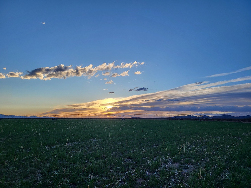
We had noticed green fields with irrigation systems along the highway when we drove to the border, and we decided to check this out for our evening walk. I knew from Philip that there is a big onion and chili farmer in the area, and we wondered if these fields might have been planted to onions. When we got there we were surprised to find that these were not onions but grain, in this case barley shortly before the heading-out stage. We didn't think precious water would be used for grain here, but we obviously were mistaken. It would have been interesting to talk to a farmer. 


Monday, March 18, 2024

Going back west looking for better weather: Dripping Springs Natural Area near Las Cruces

 Saturday, March 16

We decided to give up on our idea to visit the Carlsbad Caverns when we found out that it is necessary to reserve a time – and no time slots were available until Monday afternoon. Had the weather forecast been better this wouldn't have mattered much, but it was supposed to turn colder and windy with an increased probability of rain. It looked better further west, and we headed out that way Saturday morning after another great Mexican breakfast at “El Alamo”.

 The hiking trail we had abandoned a few days earlier near Las Cruces was on the way to Columbus on the Mexican border, our destination for the night, and since there was no rain in the forecast we chose that as our hike of the day. Without any trouble we found the A.B. Cox visitor centre in the Dripping Springs natural area, checked in there to make sure we had the right trail, and were on our way early in the afternoon. 


This is an easy in-and-out hike, about a mile and a half each way, with a slight but steady incline on a wide trail. At one point it was used as a road to get to the springs – or more accurately the Van Patten Mountain Camp built nearby in the late 1900s, a resort with 32 guest rooms, dining hall and entertainment popular with well-to-do visitors and New Mexico State University students for several decades. It's easy to see why this would have been a favourite destination: the location is gorgeous, tucked right into a fold at the foot of the Organ Mountains, secluded yet reachable without too much effort first by horse or horse-drawn carriage, later by automobile.


Not much is left now, mostly some remnants of brick walls hard to discern from the surrounding rock from a distance. It's a lovely place to have a picnic even now, quiet, surrounded by majestic mountains, yet with an amazing array of plant life, from piƱon pine and juniper to agave and yucca, creosote and acacia to small herbaceous plants and cacti. A bit further along the trail are the remnants of another venture, a 'sanatorium' built by a Dr. Boyd used for a few years for patients with tuberculosis and other lung ailments. Here, the buildings are more intact and, like the former mountain camp, protected as national heritage.

The 'dripping springs'


When we returned to the visitor centre we had enough time to do another short hike to 'La Cueva' (The Cave), used by the Jornada Mogollon people around 5000 years ago already. Their artifacts – pottery sherds, stone scrapers, manos (grinding stones) and projectile points – have been found in excavations in the area. The roof of the cave, which is not a true cave but rather a shelter in the rock, is blackened from centuries of fires. It must have been a great location, well protected, with water nearby and a good view of the valley below. A slickrock 'ramp' leads up to it, with several deep grinding holes.


We left mid-afternoon and took I-10 south to El Paso, TX, happy we could leave big cities behind soon after: we now took the CR9 west towards the village of Columbus, about an hour's drive on a narrow, little-travelled road hugging the Mexican border. Here, we saw the much-talked about 'wall' for the first time and were reminded of the wall dividing Germany which we knew from our childhood and youth, only that this is not wall but more like a fence. We were to see it closer up the next day, but more about that later.

We arrived shortly before sunset, the landmark water towers outlined against the glowing sky, our beautiful small adobe hotel 'Los Milagros' (Miracles) welcoming in the evening light.


Sunday, March 17, 2024

What to do in Alamogordo? Visit Three Rivers Petroglyph Site


We chose Alamogordo as a place to stay because it was the closest to White Sands NP. What it is famous for, however – and I hadn't been aware of that – is its association with the Trinity Project, the first-ever detonation of an atomic bomb in 1945 in the nearby White Sands Missile Range.


Humans have lived here for at least 11,000 years and left many traces. We decided to look at the ancient rather than the more recent history of the area. About half an hour's drive north from Alamogordo is Three Rivers Petroglyph Site where, in an area about 50 acres in size, more than 21,000 petroglyphs have been found and carefully charted. They date back from the time of the Jornada Mogollon people who lived here intermittently between about 200 and 1450 CE before disappearing completely. The reasons for their disappearance are not conclusive: was it drought, heat and famine, war, a combination of those or something else altogether? Just as much of a mystery is the meaning behind at least part of their rock carvings. Some are very clear: sheep, birds, lizards, human faces. Others very likely are of spiritual origin. There are no known descendants in the area any longer, and the interpretation remains speculation.


We decided to visit the site yesterday and spent a few hours in the afternoon climbing up the petroglyph trail behind the visitor centre. The amount of carvings is indeed stunning, the quality of many of them amazing, considering how many years they have endured. They were made with stone tools, some by scratching through the dark (oxidized) patina on the exterior of the rock, some by pecking through it using two rocks like hammer and chisel.

 The view as we climbed up the trail, which is about a mile in length, is stunning: to the east towers the Sierra Blanca, some of the mountains still showing traces of snow, to the west stretches the Tularosa Basin with White Sands NP with the backdrop of the San Andres and Oscura mountains. During the night we had listened to the howl of the wind in our motel, and we struggled against it on the hike. Looking over to where we had been the day before we saw huge clouds of dust moving, obscuring the mountains behind. Now we were glad that we had changed our plans and visited White Sands the day before. It seemed likely that visitors wouldn't even be allowed to enter the park under these conditions.

After returning to the visitor centre parking lot we walked the short cemented trail to the south leading to the prehistoric village where the Jornada Mogollon people lived. Here a replica of a pit house and later above-ground structures showed where these people had settled. The climate must have been quite different, with more precipitation, since they were practicing agriculture and settled here for such a long period of time.


We decided to check out 'historic downtown' after we returned but found nothing very interesting. It didn't look as if the efforts to revive it were overly successful in making it more attractive to visiting tourists. If that is the case now, at about the busiest time for visitors to the area, it likely won't be much different through the rest of the year. “White Sands Boulevard”, the main thoroughfare, on the other hand, on which our motel was located is one long line of fast-food restaurants, likely catering to tourists passing through to and from White Sands National Park. 

Another attraction - one we decided not to visit - is McGinn's PistachioLand. Pecans and, to a lesser degree pistachios, are grown all throughout southern New Mexico, and it would have been interesting to learn about them, but the strong winds would have made a tour of the orchards very unpleasant, and when we briefly stopped in their parking lot people were lined up to get into the gift shop. Here is a photo of one of the orchards close to the visitor centre.