I took a long break, mostly due to the fact that this is a
very early spring here in Alberta, and our field work started before I could
finish reporting on the rest of the trip. The fields are once again seeded, and I’ll try to gather my thoughts and pick up where I left off.

Monday, March 14th
The ‘Coffee Cup’ in the historic downtown district of Boulder
City was our choice for breakfast, just like last year. We needed a hearty
foundation for the hike we had planned for the day. We stopped at the National
Park visitor centre just before the Hoover Dam to make sure the rumours we had
heard about Ringbolt Hotsprings being closed were not true – that was our big
worry. What if we couldn’t show our friends this most amazing place? But our
fears were soon put to rest: only during the hottest part of the year this hike
is not recommended.

Unlike last year we stopped at the Hoover Dam bridge for a
good look at the dam. It is, after all, a major tourist attraction, and even I
had to admit that it’s an impressive construction. Seeing it wedged into that
narrow canyon it didn’t surprise me very much to read that more than a hundred
workers had lost their lives during the five years it took to build it. Lake
Mead, the lake formed by damming the Colorado River, is the biggest body of
water in the United States (by volume); right now the water level seemed quite
low, though I don’t think any lower than last year around this time.

After the more technically minded part of our group had
satisfied their inquisitiveness we drove the short distance to the Arizona Hot Springs (Ringbolt Hot Springs) trailhead. It was late
morning, and the sun quite hot already.

Once we had traversed the half kilometre or so down the gravelly path and the steep canyon walls enclosed us it was nice and cool, the highway far enough in the distance that traffic noise didn’t interfere with the bird song from somewhere high above us.
 Golden California poppies
and brittle bush set the reddish rock ablaze, and in really shady niches I found
this beautiful plant with its furry leaves and flower buds.
Golden California poppies
and brittle bush set the reddish rock ablaze, and in really shady niches I found
this beautiful plant with its furry leaves and flower buds.

Creosote bushes are tough enough to endure even the most adverse growing conditions, and their roots seem to bore through sheer rock. Sometimes I wonder what could possibly sustain them.

Lagging behind the
others a bit a sudden movement caught my eye: a hummingbird, coming to rest
briefly on the branch of a creosote bush, unconcerned by my presence. Unfortunately
my camera wasn’t up to capturing this encounter.


Our destination for the night was Kingman, only
about an hour and a half’s drive. Here, we had arrived at Route 66, and this,
of course, called for a fitting dining experience at “Mr. D’z Route 66 Diner”. http://www.mrdzrt66diner.com/
With its gleaming chrome, pink and turquoise furnishings, the juke box in the corner and Marilyn Monroe and Elvis Presley smiling from every wall it felt like we had been transported back to the fifties, and after a meal of burgers and fries we were ready for a good night's sleep. Tomorrow, after all, we would experience another highlight: the Grand Canyon.

Once we had traversed the half kilometre or so down the gravelly path and the steep canyon walls enclosed us it was nice and cool, the highway far enough in the distance that traffic noise didn’t interfere with the bird song from somewhere high above us.


Creosote bushes are tough enough to endure even the most adverse growing conditions, and their roots seem to bore through sheer rock. Sometimes I wonder what could possibly sustain them.


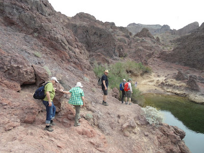
Around noon we reached the Colorado, its calm waters a
welcome opportunity to cool our heels. We saw a couple of canoes drifting upstream,
a vulture drew its slow circles overhead. It is hard to believe that this is
the same river that roars with such enormous force through the narrow walls of
the Grand Canyon. Here, it would be no problem to manoeuvre a canoe even for a
novice paddler, and indeed it’s another favourite way to reach the Arizona
Hotsprings via that route.

We still had the more difficult part of the trail ahead
before we would reach the hot springs themselves.

Now, the much narrower path
hugged the cliff side for a bit before ascending through a short ‘chimney’ and
descending to the mouth of the next canyon.

We only had to follow the trickle
of water now, the walls of the canyon narrowing evermore, the shallow,
increasingly warmer water filling the whole width of the path soon.

It was much
easier walking barefoot now than trying to find dry rocks to step on, the
gritty bottom stimulating the soles of my feet. The few slip rock passages,
too, were easier to manage barefoot, though a few of us tackled them in a
different manner.

Only when we reached the ladder – no longer a worry for me
like last year – I put on my shoes for a little while again.

Once we had all clambered up the ladder we could reap the
reward for the hike: the warm pools of Ringbolt hot springs awaited us, a
welcome opportunity to stretch our limbs in the water, enjoy a beer (which
would have tasted only slightly better if it had been really cold), and marvel
once again at the amazing setting of this great place.


The uppermost of the three pools was just as hot as I
remembered, and we quickly sloshed through on our way out higher up into the
canyon that would lead us back to the parking lot eventually. We spread out our
lunch on some flat rocks in the shade of a few creosote bushes and replenished
the sun screen before winding our way through the walls of the canyon, which,
after a while, opened up to a wide, gravelly area, affording a good view of the
steep path we’d take to get up to where we had started.

As so often, the way back
seemed shorter the second time around. Every once in a while I turned around to
take in the amazing view of the landscape below. No snakes, hardly any small
lizards crossed our path; I was quite thankful for the lack of the former. We
had been told in Phoenix already that snake sightings had been earlier than
last year after the mild February.

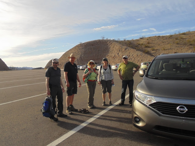
Once we gained the plateau the landscape became less
dramatic, and soon the highway and the parking lot with our trusty Nissan Quest
appeared in the distance. Hot, tired and happy we reached the end of our hike.

With its gleaming chrome, pink and turquoise furnishings, the juke box in the corner and Marilyn Monroe and Elvis Presley smiling from every wall it felt like we had been transported back to the fifties, and after a meal of burgers and fries we were ready for a good night's sleep. Tomorrow, after all, we would experience another highlight: the Grand Canyon.


