Saturday, November 16, 2019

A view from the top: hiking up to Monserrate

Looking from Monserrate to Guadelupe
The sun was shining through the window when I opened the shutters to the narrow enclosed balcony running alongside the first floor of our Sayta Hostal, promising clear views for our planned hike up Monserrate Hill.

We were on our way by a quarter past ten, along the now already somewhat familiar little streets to a bigger tree-lined thoroughfare that we followed uphill for about twenty minutes. Traffic was heavy along that road, and, despite what I wrote yesterday, pollution was still noticeable. Thank goodness we didn't have to deal with this all the way up. We eventually reached the parking lot that marks the start of the stairs. There are easier ways to reach the top, no doubt: a cable car and a funicular are the other options. But it is, after all, not only about reaching the destination, it is about the way.

Monserrate Hill and its counterpart, Guadelupe, were sacred to the indigenous Muisca already long before the Spanish arrived. The latter tore down the temples and built churches in their stead. The strenuous walk to reach either has been done as a pilgrimage from those days on.
 
We passed through a gate manned by a soldier, as in many public places there for security reasons; we would encounter more at different stations along the trail. People of all ages were on the way either up or down, and small stands with refreshments, from water to ice cream, bananas to pineapple and watermelon, baked goods, chocolate, candy, but also beer, empanadas and grilled meats made good business from the crowd. Right at the beginning of the trail an old man with a scale tried to attract attention: for a small fee you'd be weighed, given a slip of paper with the amount and, supposedly, could check if you had lost any weight by the time you passed him again after the hike. When we passed the spot again on the way down he was gone, however. Tough luck for those who had hoped to find out if the pilgrimage had any side benefits.


The sun was hiding behind clouds for much of the way up, thankfully; it was hard enough to walk without heat adding to the strain. The stairs consisted of mostly long steps built from rocks; each one required at least two steps, sometimes three. Lush vegetation lined the trail on both sides, flowers in shades of red, pink, purple and yellow attracting butterflies and birds. The air was fragrant here, exhaust fumes long forgotten. I thought I heard the familiar twitter of hummingbirds a few times, and finally I saw a beautiful green metallic one darting from flower to flower.


I had to stop often to catch my breath and was soon drenched in sweat, but I was by far not the only one. The altitude gain on the hike is 465m over the course of about 2.5 km, and by the time we reached the church we were at 3,152m above sea level. I was surprised how many small children, looking no older than maybe three or four, walked up with parents or grandparents. There were runners in sports gear hastening up or sprinting down, old people who were obviously not well off, judging by their footwear that, in some cases, was in tatters, groups of young people engaged in lively conversation, some with music playing on phones to make walking more pleasant. Near the top an old man was pulling himself up step by step on the railing, determined to make it. And then, just when it seemed it would never end, the stairs turned into a walkway with only a slight incline for a bit before commencing for one last push: we had reached the destination. The view from the top was indeed stunning: much of Bogotá was spread out in the valley below, and after some searching we found Plaza Simon Bolívar and the cathedral. In the distance clouds were rising from the mountains. The sun had come out again, and the church gleamed pure white.
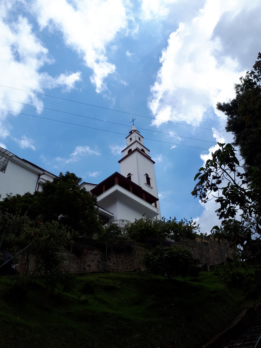

Loads of people were milling around in front of it, crowds spilling down towards restaurants and souvenir shops we chose to avoid. Many had come up via the cable car or funicular, no doubt, but I'm still amazed how many of them walked. We had a look at the church, surprised how plain it was compared to other catholic churches we had seen in South America. The only more elaborate part was a gilded side altar that featured a black madonna and child, quite beautiful. Maybe the relative plainness was due to the fact that this was a pilgrimage church?


The way down took us less than the two hours we had needed for the way up, but was hard on the knees, of course. Yet it was great to be there, the city with all its noise far below, to share the way with so many others who had come for so many different reasons.

We stopped at Candelaria, the same restaurant where we ate yesterday, recommeded by our hostel manager John as a place where the locals eat (he was right – not a single foreigner in the rather big place), and enjoyed the cold beer as much as the Arroz mixto, rice mixed with chicken and vegetables. The siesta that followed was much needed as well. I wonder how our bodies will feel tomorrow ...

It will be a slower day, however, so we should be able to recover. We have booked a room in Zipaquirá, a smaller city about 50km to the north of Bogotá, famous for its salt mines and a salt cathedral. Tomorrow morning we plan to visit the Museo del Oro after breakfast and then make our way to Zipaquirá by bus sometime in the afternoon.

Friday, November 15, 2019

The start of the journey: Candelaria, Bogotá

The yellow building straight ahead is the Sayta Hostal

Two flights, fourteen and a half hours – that's what it took to transport us once again to a different world. We left home at 4:30 yesterday morning, the predicted fog patches more like a sea of fog for the first half hour or so, but thankfully clearing to reveal the still full moon, to leave for Toronto at 7:15. There, too, wintry conditions awaited us, but nothing stood in the way of our leaving on time for Bogotá, starting point for this year's Latin America journey.

As soon as we reached the lineup for the imigración, snaking back and forth in several long rows, we were vividly reminded of our last arrival at this airport in March of 2018. Then, we had a connecting flight with the south American airline Avianca and were very much afraid of missing it because we had to go through immigration first and moved so painfully slow. We finally cut through the lines, asking for understanding, and were given room to make it to the front of the queue quickly, sprinting to the Avianca check-in counter in record time. No such excitement this time: in due course we were given our stamp (oh yes, we watch closely for that every time we enter a country here), put our bags on the conveyor belt to be checked by customs and found the taxi office close to the exit.

The van zipped through the thick traffic near the airport and pretty open roads further towards the centre and, after about half an hour, dropped us at our Sayta Hostal close to midnight. We had stayed here for a couple of nights almost seven years ago, shortly after it opened, and found it much as we remembered, even got the same room – not a difficult proposition since there are only four of them, and only two private ones. I tried in vain to find my blog entry from that time in this blog site and realized I had then still posted on my other blog, Musings From The Farm. It was nice to read up on it before we left home.

This is not only a beautiful old house with its curved yellow facade with the white and green trim, but also a great location in Candelaria, the historical part of Bogotá. 
Just a few minutes from our hostal is Bogotá's oldest plaza, Plaza del Chorro de Quevedo. It is considered to be the birthplace of Bogotá. Supposedly the Spanish conquistador Gonzalo Jiménez de Quesada founded it on this square on August 6, 1538. It is a tiny, very popular space, surrounded by houses both old and more contemporary. Narrow, cobblestoned lanes run back and forth through this neighbourhood, with many small shops and restaurants. 


After breakfast this morning we went in search of a Scotiabank to draw money from the ATM. There are many ATMs, of course, from a lot of different Colombian banks, but we have found that the Scotiabank usually works, lets us withdraw a bigger amount at once and charges no or a relatively small transaction fee because we have a Scotiabank account at home. This search proved to be a wild goose chase: Johann had checked on Google Maps for the location(s), but try as we might we didn't find it where it was supposed to be, nor anywhere in the vicinity. We had a nice walk through the old part of the city, however. As so often I was as much taken by the beautifully restored colonial houses as by the crumbling facades that showed the splendour of better days, by the small calles (lanes), the people engaged in lively conversation. That is one of the first things I notice when I come to any Latin American country: people tend to walk in groups, animated, turned towards each other, younger women or men holding the arm of older ones, always respectful. One doesn't often see young people concentrating solely on their cell phones, faces turned down, oblivious to their surroundings.
Of course the usual din of traffic is part of the picture, too: a lot of taxis, motorbikes weaving in and out of lanes, here and there an old truck lumbering up one of the narrow streets, spewing masses of black exhaust. I would say it has improved quite a bit since we were here last, though: Bogotá is trying very hard to clean up its act. Recycling is everywhere, and here in this part of town at least there is not a lot of garbage littering the sidewalks.


What I also noticed were the many graffiti murals, often real works of art, so much so that free graffiti walking tours are now offered. We did a guided city walking tour in 2012 and won't do that again this time, but the graffiti is easy to find everywhere.


We decided to try our luck with the other Scotiabank location in the afternoon and walked to the main square bordering the cathedral, surrounded by impressive government and municipal buildings. It was teeming with people, a different musical presentation every twenty metres or so, from Colombian folk music to techno and opera arias, a cacophony of sound. Although this location seemed easier to get to it turned out to be just as difficult, and we finally found it after asking a couple of times. Thankfully it provided what we had come for as well. The Colombian currency takes a bit of getting used to: the exchange rate is COP 2,500 for 1 Canadian dollar, so one is always dealing with huge numbers and bank notes.

Unfortunately I left home with a nasty cold, which didn't improve with ten hours on airplanes, of course; the altitude of 2600m is probably not great for it either. This day of little activity and more sleep has helped, maybe the more humid air as well, so hopefully we can walk up to Monserrate tomorrow, the hill towering above the city. It is a very popular destination for both tourists and Colombians, the latter often doing the walk as a pilgrimage to reach the big church of the same name built at the top. One can reach it either by walking (all stairs), or use the funicular. We plan to do at least the walk up on foot. Hopefully the weather will cooperate. Today it was cloudy, and all day it looked as if it might start to rain any minute, but never did. The temperature is a pleasant 19 or 20, dropping to about 9 or 10 degrees Celsius overnight, enough to make me appreciate the heavy woolen blankets on the bed. 
 
View from the hostal
 

Thursday, August 1, 2019

Cycleforward 2019: Black Diamond to Waterton National Park


It’s been over a week now since we returned from this summer’s Cycleforward trip, which led our group of about 25 to the foothills of southwestern Alberta all the way to Waterton National Park. A couple of weeks earlier I had injured my ribs in a fall, so I decided – reluctantly but wisely, as it turned out - against biking and drove our pickup as one of the accompanying vehicles instead. It somehow doesn’t feel right: a big part of this adventure is the time spent together on the bikes, enjoying the landscape immediately as it is only possible in biking, hiking or horseback riding, facing the same difficulties as your fellow bikers. Both were abundant on this trip, beautiful landscape and challenges, and even watching from behind or driving by I saw what this brave and strong group of people were dealing with: long drawn-out climbs, sometimes steep hills, very strong winds and intermittent showers with not very summery temperatures. 


View from Tullichewan Ranch near Black Diamond

I don’t feel fully qualified to report on more than this, so will just include photos of our stops at the ranches of two friends, Ben and Steph’s ‘Grazed Right’ Tullichewan Ranch near Black Diamond and Nick’s, Holly’s and Jack’s place near Pincher Creek, both gracious hosts generously opening their homes and yards to our big group of people. 
Bar U Ranch National Historic Site on the way south along Hwy. 22


I also have a few photos from our second night at Chain Lakes campground where we had a large group site all to ourselves, surrounded by amazing wildflowers. 
 
Chain Lakes Campground


Gaillardia (Blanket Flower)
 
Fleabane  
 
Western Wild Bergamot  


Sticky Geranium
Old Man's Whiskers (Geum Triflorum)
Lunch break at the Oldman River


Morning rainbow near Pincher Creek

A visit to Head-Smashed-In-Buffalo-Jump


Getting close to Waterton
View from Crooked Creek campground

Crooked Creek campground, where we spent the last two nights, only a few kilometres away from the entrance to the gates to Waterton NP, was very nice as well, except that we experienced less than perfect weather on the last morning and decided to either turn north towards home instead of staying an extra day, or south into Glacier National Park in the US, something Johann and I had planned originally and took up again when it rained all morning with a temperature of only 9 degrees Celsius.  

Biking up to Red Rock Canyon, Waterton NP

Waterton Lake, view from the Prince of Wales Hotel - better hang on to your hats (and grandchildren)